

Utility Mapping
Utility mapping is a critical process for understanding and managing hidden and visible infrastructure. Here are some of the specialized utility mapping services we provide, and we would be happy to discuss how they can meet your project needs. We will help you understand the specifics of each and which will be the best service to ensure the success and safety of your work.
Underground Utility Mapping
Underground utility mapping is the process of accurately identifying, locating, and mapping subsurface infrastructure such as gas lines, water pipes, sewer systems, electric cables, and communication lines. Maven works closely with industry trusted partners to provide the most accurate locations for underground utilites possible. These partners use many different technologies such as Ground Penetrating Radar, magnetic detection, and acoustic pipe detection. This essential information helps prevent costly damage during excavation, facilitates informed design decisions, and ensures compliance with safety regulations. Detailed utility maps are critical for urban planning, construction, infrastructure maintenance, and risk assessment.
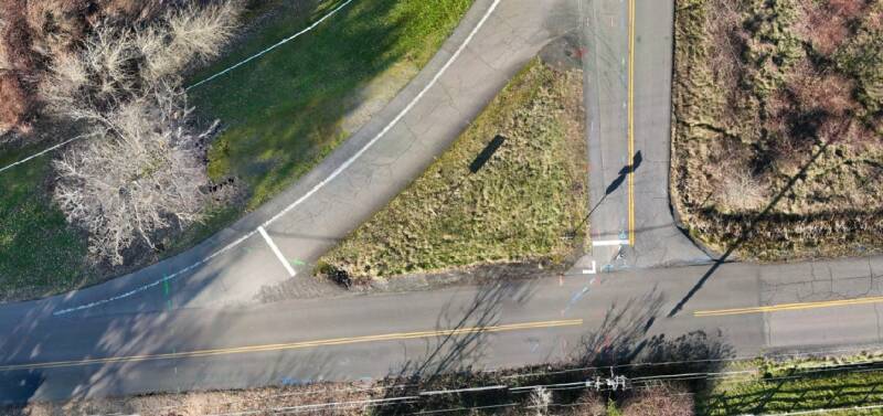
Aerial Utility Mapping
Aerial utility mapping leverages Unmanned Aerial Systems (UAS), or drones, to efficiently collect comprehensive data on above-ground utility infrastructure. This includes power lines, communication towers, pipelines, and other linear assets. Drones capture high-resolution imagery, LiDAR data, and thermal scans, allowing for detailed inspections, condition assessments, and precise mapping of utility corridors. This method offers significant advantages in terms of safety, speed, and data accuracy compared to traditional ground-based methods, providing critical insights for maintenance, planning, and emergency response.

3D Utility Modeling & Visualization
3D Utility Modeling & Visualization involves creating detailed three-dimensional digital models of utility networks, both above and below ground. Using advanced laser scanning, photogrammetry, and specialized software, Maven Mapping Solutions transforms raw data into comprehensive 3D models. These models provide an immersive and accurate representation of complex utility environments, facilitating clash detection, design coordination, volumetric analysis, and construction planning. By delivering highly detailed, georeferenced 3D datasets, this service minimizes errors, improves stakeholder communication, and provides a powerful tool for informed decision-making in infrastructure projects.